


Voting District 11257, Los Angeles County, California
About
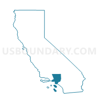
Outline

Summary
| Unique Area Identifier | 533581 |
| Name | Voting District 11257 |
| County | Los Angeles County |
| State | California |
| Area (square miles) | 3.32 |
| Land Area (square miles) | 3.32 |
| Water Area (square miles) | 0.00 |
| % of Land Area | 99.95 |
| % of Water Area | 0.05 |
| Latitude of the Internal Point | 34.03943500 |
| Longtitude of the Internal Point | -117.73872110 |
Maps


Graphs
Select a template below for downloading or customizing gragh for Voting District 11257, Los Angeles County, California


Neighbors
Neighoring Voting District (by Name) Neighboring Voting District on the Map
- Voting District 11227, Los Angeles County, CA
- Voting District 11236, Los Angeles County, CA
- Voting District 11254, Los Angeles County, CA
- Voting District 44520, San Bernardino County, CA
- Voting District 44535, San Bernardino County, CA
- Voting District 44550, San Bernardino County, CA
- Voting District 44560, San Bernardino County, CA
- Voting District 44580, San Bernardino County, CA
- Voting District 44625, San Bernardino County, CA
- Voting District 44705, San Bernardino County, CA
- Voting District 44720, San Bernardino County, CA
Top 10 Neighboring County Subdivision (by Population) Neighboring County Subdivision on the Map
- East San Gabriel Valley CCD, Los Angeles County, CA (935,875)
- Ontario CCD, San Bernardino County, CA (615,598)
Top 10 Neighboring Place (by Population) Neighboring Place on the Map
- Pomona city, CA (149,058)
- Chino city, CA (77,983)
- Chino Hills city, CA (74,799)
- Montclair city, CA (36,664)
Top 10 Neighboring Elementary School District (by Population) Neighboring Elementary School District on the Map
Top 10 Neighboring Secondary School District (by Population) Neighboring Secondary School District on the Map
Top 10 Neighboring Unified School District (by Population) Neighboring Unified School District on the Map
Top 10 Neighboring State Legislative District Lower Chamber (by Population) Neighboring State Legislative District Lower Chamber on the Map
Top 10 Neighboring State Legislative District Upper Chamber (by Population) Neighboring State Legislative District Upper Chamber on the Map
Top 10 Neighboring 111th Congressional District (by Population) Neighboring 111th Congressional District on the Map
- Congressional District 26, CA (691,452)
- Congressional District 42, CA (667,638)
- Congressional District 38, CA (641,410)
Top 10 Neighboring Census Tract (by Population) Neighboring Census Tract on the Map
- Census Tract 3.01, San Bernardino County, CA (8,795)
- Census Tract 4026, Los Angeles County, CA (7,453)
- Census Tract 4025.02, Los Angeles County, CA (7,225)
- Census Tract 3.03, San Bernardino County, CA (7,169)
- Census Tract 4030, Los Angeles County, CA (6,835)
- Census Tract 4029.02, Los Angeles County, CA (6,445)
- Census Tract 4.01, San Bernardino County, CA (6,387)
- Census Tract 4027.02, Los Angeles County, CA (6,313)
- Census Tract 4033.18, Los Angeles County, CA (6,243)
- Census Tract 4028.01, Los Angeles County, CA (5,170)